

In addition to the Albula Pass, the Julier Pass also crosses the Albula Alps - a striking mountain range whose highest peak is the 3418-metre-high Piz Kesch. Our destination today, however, is a little lower: the 3380-metre-high Piz Julier - or, as it is called in Rhaeto-Romanic, Piz Güglia. It's said that you can enjoy a spectacular view from its summit - and that's exactly what I want to finally experience on my second ascent, because unfortunately we couldn't enjoy the view at all on the first one due to the fog.
Piz Julier is a real lump of granite and gneiss. It towers high above St. Moritz, its steep rock faces towering impressively into the sky. The first climbers ventured all the way to the top back in 1859. Today's ascent is marked white-blue-white and classified as T5- according to the SAC scale - in other words, surefootedness and a head for heights are not recommended here, but mandatory.
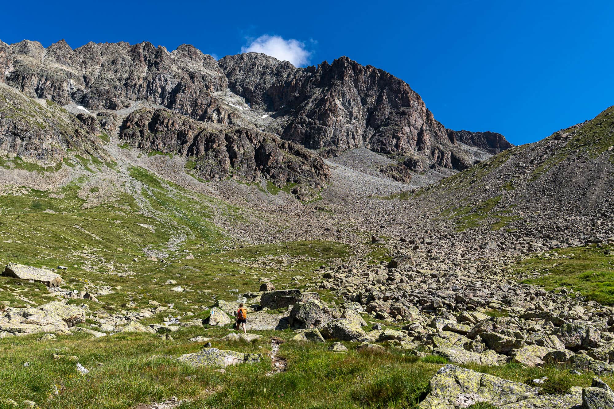
Most alpine hikers start their tour from the Julier Pass. A small parking lot to the east of the pass is the ideal starting point. Steep, but technically not very difficult, the trail leads uphill along sandy and screey paths. Further up, it winds its way through an impressive boulder field in the Munteratsch area. Sometimes we hop from stone to stone, sometimes we follow the path - around 700 meters in altitude have to be overcome before we reach Fuorcla Albana at 2,869 m in a wide left turn.
Historically, the crossing between St. Moritz and Silvaplana never played an important role, neither for trade nor for the military. And yet there is a small stone refuge here. It offers a welcome retreat in an emergency, as shelter is rare on the otherwise exposed ridge, especially if a thunderstorm suddenly approaches faster than you would like.
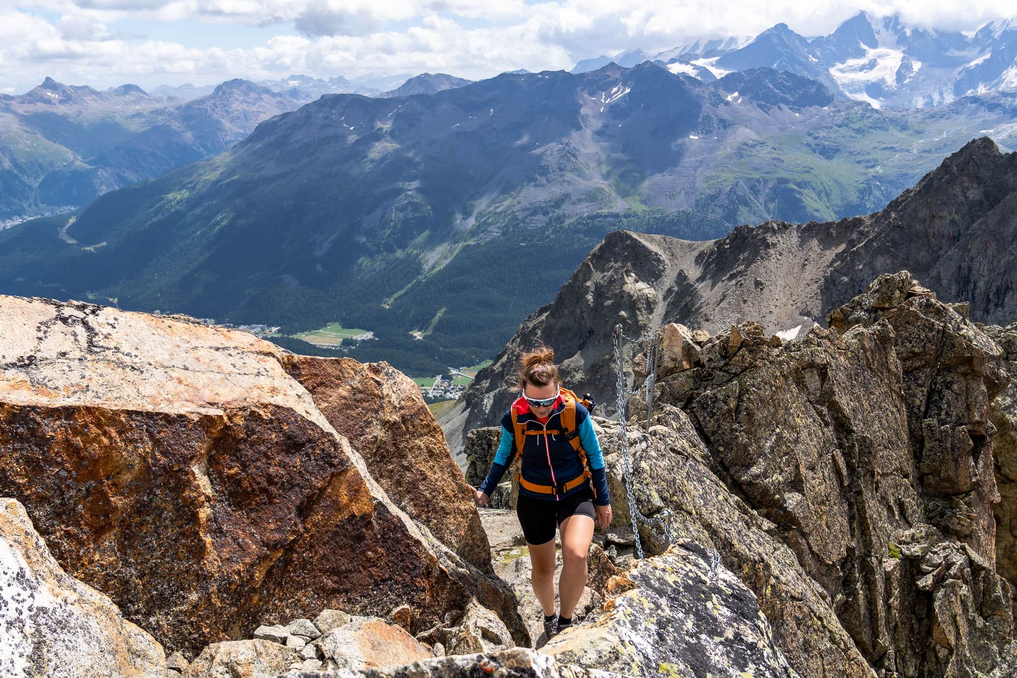
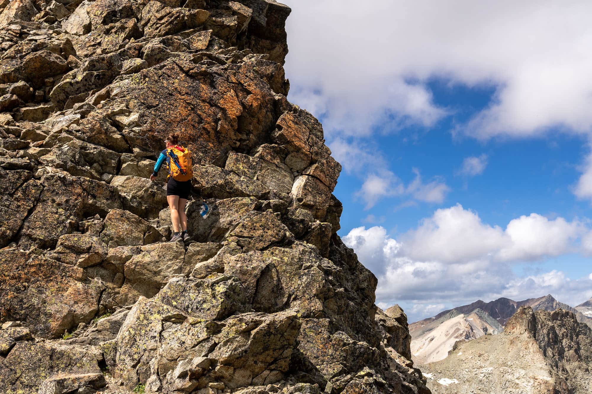
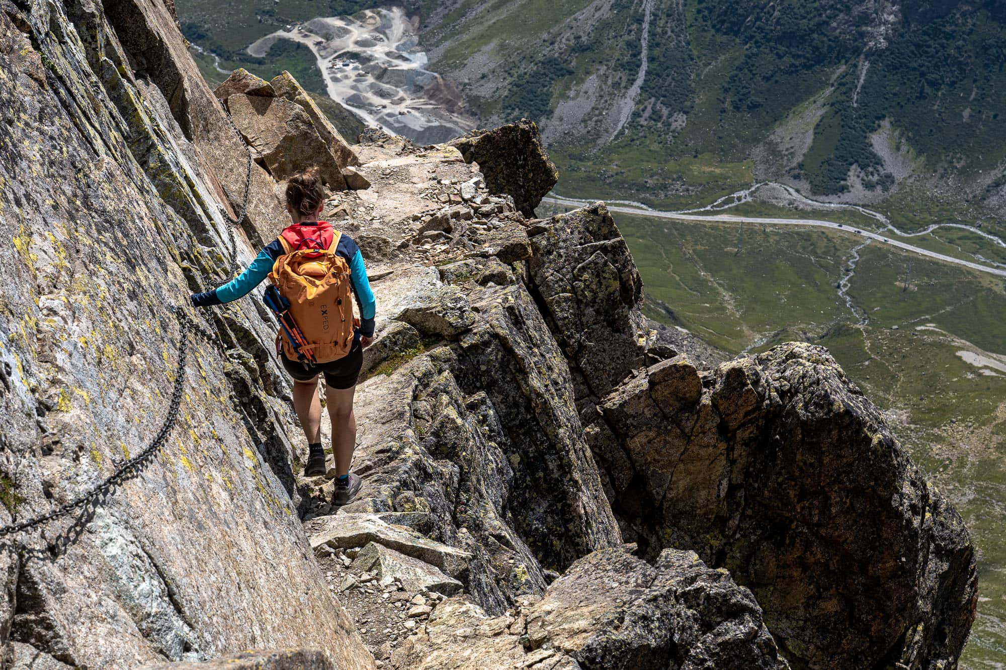
So instead of descending back towards St. Moritz, we continue the ascent - northwards, along the ridge. Around 500 meters in altitude still separate us from the summit. The Crasta da la Senda is steep, exposed and offers breathtaking views. Chains and iron poles provide support and defuse some tricky sections. But the trail remains challenging: if you don't have a head for heights, you won't have much fun here. I speak from experience: on my first ascent attempt - over a decade ago and with little mountain experience - I had to turn back because my fear of heights got the better of me.
On other hikes in the Engadin we have already encountered many ibexes. On this day, however, we have no luck and don't encounter any of the impressive climbing artists with their curved horns. Instead, we are rewarded in another way, as the view from Piz Julier is anything but guaranteed. On my first ascent a few years ago, I stood at the summit but couldn't see a thing. Pure whiteout: the summit was in the middle of a thick cloud, which is not uncommon here.
As the highest point between the surrounding mountains, Piz Julier acts like a magnet for clouds. But today: perfect weather. The surrounding mountains glow in all shades from light grey to anthracite to rusty red and the variety of colors in this otherwise barren landscape looks like a painting. I want to soak up every detail of this panorama and never let go. In moments like this, you know exactly why you keep going back to the mountains.
Now in summer, the landscape is a lush, vibrant green and the slopes are full of life and color. But in autumn, the Engadin is transformed: when the needles of the larches turn golden yellow, the landscape is bathed in a warm, almost magical light. Everything glows as if someone had put a filter over the valley: a golden Engadin on a whole new level.
Deep below, the lakes glisten turquoise. Lake St. Moritz on the left, Lake Silvaplana on the right and even from up here, the colourful kites of the surfers are clearly visible. The Maloja wind, a thermal valley wind, is created by the temperature differences between the warm slopes and the cooler air in the valley. These reliable wind conditions make the spot a paradise for windsurfers and kitesurfers in summer. The combination of blue water and magnificent mountain scenery is simply unique.
The descent along the well-secured ridge is quick and easy. We take a final break at the refuge on the Fuorcla Albana. Then it's time to take a deep breath before heading back to the starting point at the Julier Pass through the gravelly flank and the scree field.


