
The dog is a picture of misery as he stands there on the small wooden bridge just past Gasenried on this shady, chilly autumn morning, on three legs, with his fourth leg bent and his tail tucked between his hind legs. At least I can reassure the visibly frightened woman: It’s only about five minutes to Gasenried, where there’s a bus on one side and people with cars on the other who can help her take her dog—with what’s likely a broken leg—to a veterinarian. Relieved, she sets off for the final few minutes, carrying the dog, and shortly afterward I see her arrive in town, where the dog will hopefully receive help quickly.
Gross Bigerhorn (3,626 m): Switzerland’s Highest Hiking Summit
A two- or three-day hike from Grächen to the summit with a guide. Includes an overnight stay at the Bordier Hut.
from CHF 590 per person
From Gasenried via the New Trail to the Bordier Hut
After this unexpected start, I continue my ascent toward the Bordier Hut and the Gross Bigerhorn. Gasenried, at 1,660 m, is the starting point—a small, sleepy hamlet in the Mattertal, just past Grächen. Here, you don’t feel a thing of the hustle and bustle of nearby Zermatt, even though the natural scenery is no less spectacular—whether during the season when the larch trees are ablaze with color or in summer, beneath the four-thousand-meter peaks surrounding the Nadelhorn.
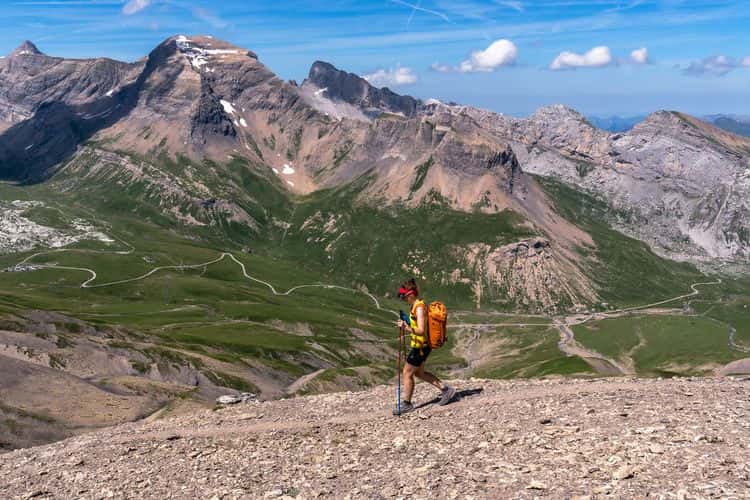
My route takes me through the village—which lies in the shade for much of the morning during this autumn season—and into a small high valley, where, on its western edge, the trail climbs steeply toward the Ried Glacier. Turn after turn, I gain elevation through dense coniferous forests that give way to larch trees further up. The ascent to the Bordierhütte was re-routed in 2023 and no longer crosses the retreating Ried Glacier. As a result, it is now “merely” a white-red-white-marked trail—though this should not obscure the trail’s length, the challenging elevation gain, and a few technically demanding sections.
I pass by the small, romantic Alpja alpine hut at 2,099 m on my left before the trail leads up to the imposing moraine of the Ried Glacier, which has long since disappeared from this area. The sweeping views down into this sandy, unstable, and steep landscape are impressive; keeping a respectful distance from the edge is certainly not a bad idea.
At around 2,400 m, the new trail turns left and, shortly thereafter, does what will later cause long faces on the way back: it descends again for a few dozen meters. Uphill sections during the descent—an adversary we’re always happy to face.
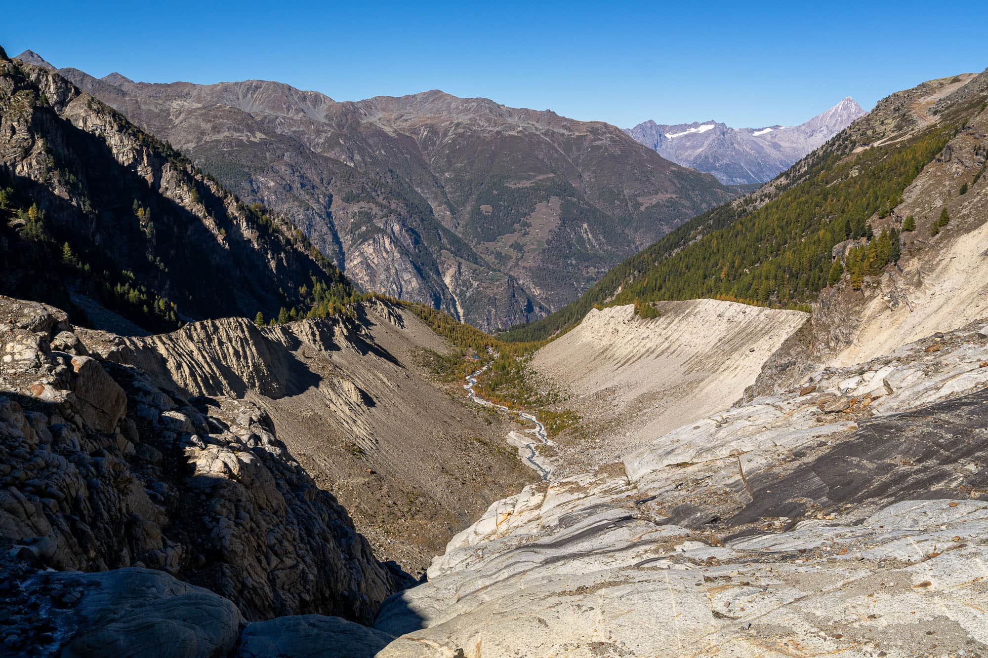
Glacier Retreat on the Ried Glacier
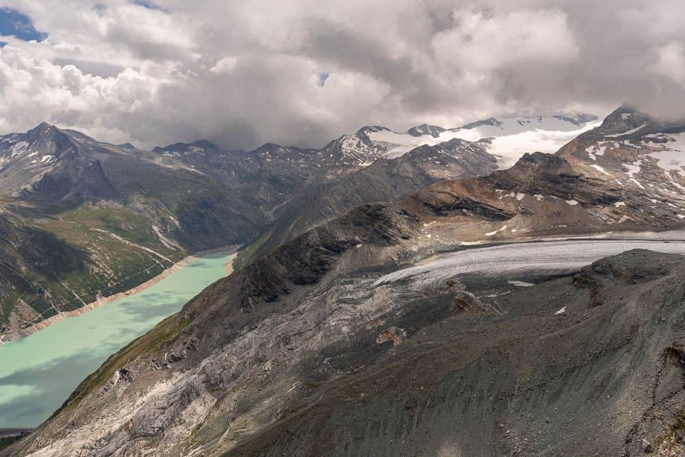
The once-mighty Ried Glacier is no longer accessible to hikers. Instead, visitors now cross its outlet via a sturdy metal bridge—in the morning over a calm little river, and in the afternoon, as the temperature rises, over a roaring torrent of melting glacial water. To the south, in 2026, one can still see an impressive glacier cave and the steep, jagged tongue of the glacier. Its north-facing orientation will certainly ensure that this imposing spectacle remains intact for a few more years, but even that will likely not protect the Ried Glacier from its fate.
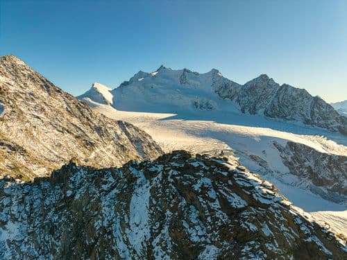
The Ried Glacier is located in the Mischabel region at the foot of the Nadelhorn, not far from the Dom, and, at around 6 km in length, is one of the larger glaciers in the Valais Alps. As recently as 1973, it covered an area of over 8 km²; since then, as with most Alpine glaciers, a considerable portion of it has disappeared. The basin formed by the glacier is framed by the Gross Bigerhorn, Balfrin, Ulrichshorn, and the Nadelhorn, which forms the western boundary with its eponymous Nadelgrat ridge. At 4,327 m, the Nadelhorn is the highest point in this mountain arena, which is regularly visited by mountaineers in the summer for high-altitude tours.
A Visit with the Ibex
The next 500 meters of elevation gain is a varied back-and-forth journey through scree and boulder fields, across alpine grassy slopes, and over a few small ladders. With a bit of luck, you might encounter ibex and chamois, which call this rugged terrain home.
Ibex usually move in small groups separated by sex and age and, during the cooler fall and winter months, increasingly retreat to lower, steep rock ledges where they can still find enough food among the sparse vegetation. Chamois are significantly smaller, usually traveling alone or in small groups, and prefer the grassier, slightly less steep areas between the boulder fields. Both species are exceptionally well-adapted to this rugged terrain and are most likely to be spotted during the quiet morning and evening hours, when there is less traffic on the trail.
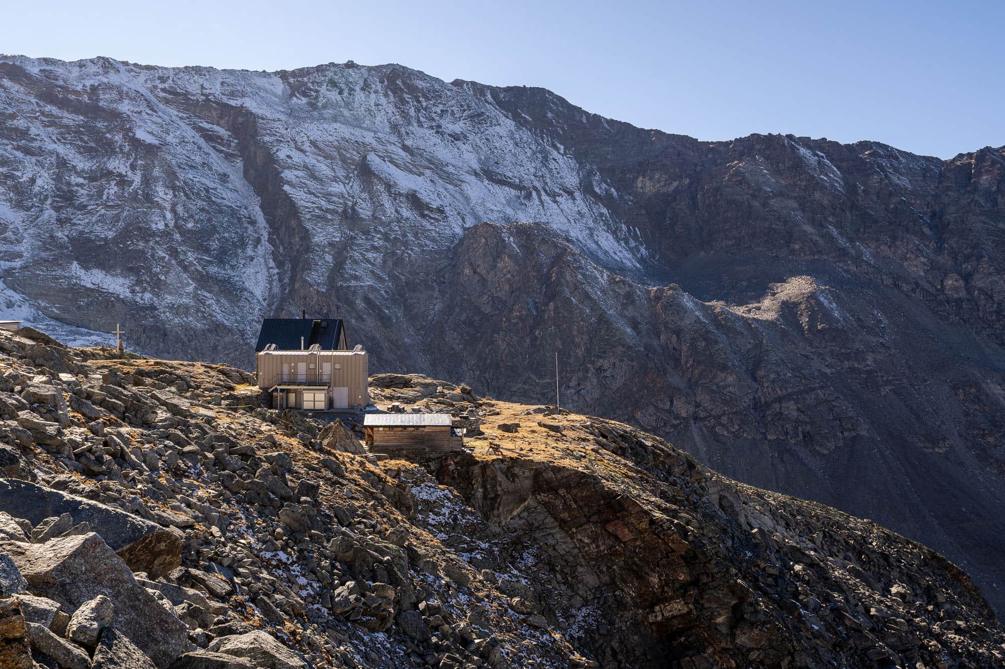
The Bordier Hut
After a final steep section with a few metal stairs, I finally reach the crest of a shady, steep slope, which leads me the last few meters up to the Bordier Hut, situated at 2,886 m. During the summer months, this is a welcome moment to take a break with a cool drink and a delicious slice of cake on the sunny hut terrace. Now, in October, however, the hut has long since gone into hibernation, and I’ve been hiking completely alone in this valley all day. My break is correspondingly short, because since I’m doing the entire round trip to the Gross Bigerhorn—including the ascent and descent—in a single day, I still have quite a distance and, above all, a lot of elevation gain ahead of me.
During the summer mountaineering season, the Bordier Hut serves as the starting point for the Nadelgrat, the long traverse from Dirruhorn (4,035 m) to Hobärghorn (4,218 m), Stecknadelhorn (4,240 m), and Nadelhorn (4,327 m). The high-altitude tour to the 3,795-meter-high Balfrin is also popular, with the descent via Windjoch to the Mischabel Hut in the Saas Valley. In winter, however, the area sees few visitors, as these are not classic ski mountaineering peaks.
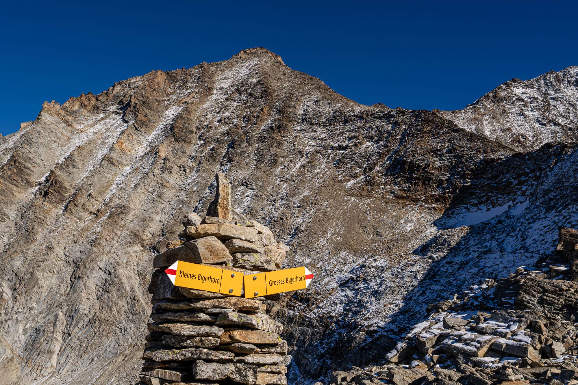
Scree fields as far as the eye can see
After the Bordier Hut, the trail finally turns into a desert of scree fields. Even on the ascent to the hut, about a quarter of the route consists of technically challenging boulder terrain. So if you’re already struggling here, you should think carefully about continuing on to the Gross Bigerhorn, because it doesn’t get any easier or less tiring—quite the opposite. Even though the ascent to the 3,626-meter-high Gross Bigerhorn is technically a hiking trail, the route cannot be compared to a classic white-red-white-marked mountain trail. In addition to the altitude, which becomes distinctly noticeable from the Bordier Hut onward, it is above all the long, technical sections through scree that are particularly demanding, as every step must be taken deliberately and carefully, both on the ascent and the descent. If wet conditions or even slippery surfaces caused by ice or hoarfrost are added to the mix, the already lengthy ascent time can be significantly extended. Navigation should also not be taken lightly, as the trail is marked from the hut but is no longer consistently recognizable.
Guided Hike to the Gross Bigerhorn
With an experienced guide by your side, you'll experience the Gross Bigerhorn over two or three days—an unforgettable experience.

The first crossing over large boulders right after the hut is entertaining; I hop from rock to rock before the trail heads toward the massive moraine, which is reached at just under 3,000 m. Reflective cat’s-eye markers make it easier to find your way at night up to this point; they’re intended especially for rope teams that set out very early in the night toward the Nadelgrat and have to find their way by the light of their headlamps, although—due to the snow having melted away from the saddle between Chli Dirruhorn and Dirruhorn—the ascent via Galenjoch is now used more frequently.
At P. 3,048, I reach a small, rocky high plateau, from which the trail continues into a barely discernible saddle between Chli Bigerhorn and Gross Bigerhorn. The altitude and the elevation gain I’ve already covered are now slowly but clearly taking their toll, so I take another short break before tackling the remaining 500 meters of elevation gain.
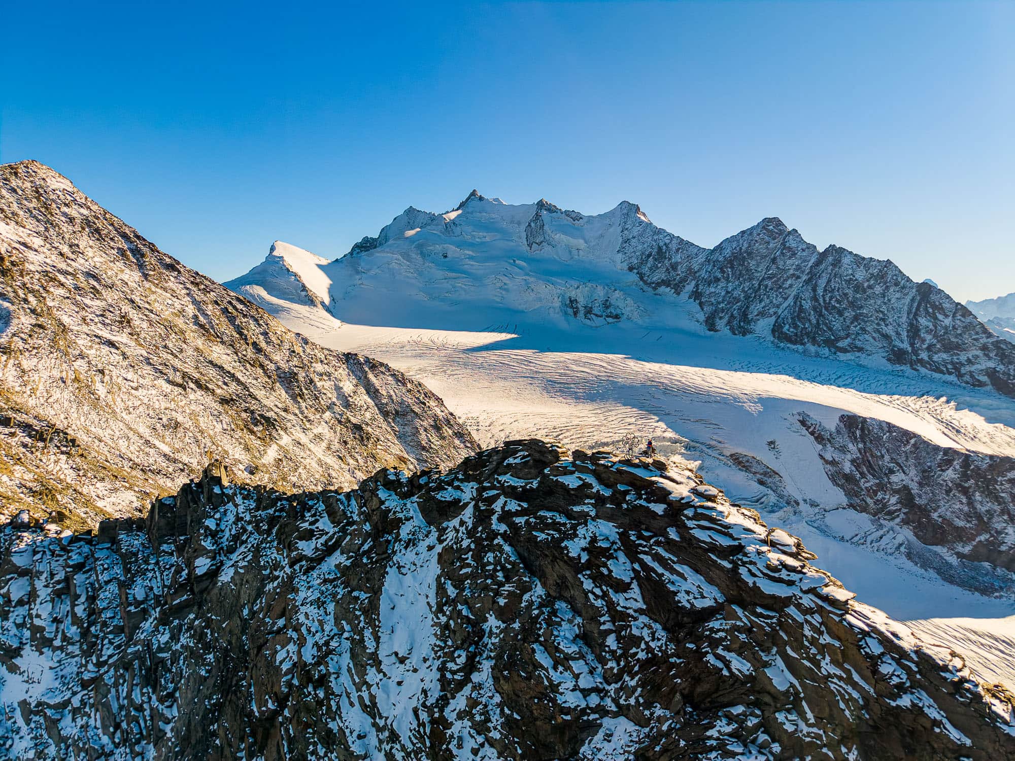
Gross Bigerhorn – Without a Rope or Crampons, Up to Over 3,600 m
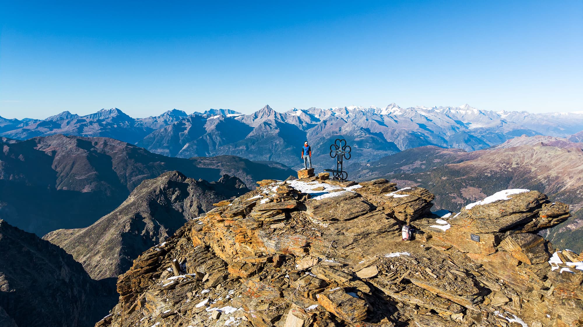
You always think that a hundred meters of elevation gain or loss doesn’t make that much of a difference. Still, it’s my subjective impression that, starting at around 3,000 m, even these seemingly small differences have a surprisingly big impact. It was to be expected, however, that after this long climb straight from the valley, I’d start to feel it a bit, and I’d factored that in accordingly. In that sense, it’s “just” a nuisance right now, and turn after turn, I continue to work my way up the scree-covered flank of the Gross Bigerhorn toward the summit. But even the longest climb comes to an end eventually, and after climbing over 2,000 meters in elevation, I stand on the 3,626-meter-high summit, with a view—impressive every time—of the surrounding four-thousand-meter peaks all the way to the dominant Weisshorn.
The Gross Bigerhorn is still glaciated on its steep north face, so the ascent from the Bordier Hut is the only way to reach its summit without coming into contact with the glacier at all. The most technically challenging sections are located in the uppermost part of the ascent, just before the summit, where the steep terrain leads to the exposed summit via several rope-secured sections.
Descent into Darkness
In October, the days grow shorter, and daylight fades quickly. Since my plan involves taking photos and filming in the evening light, I’m properly equipped—my headlamp and warm clothing are ready and packed in my backpack. The icy wind at the summit makes me keep my break quite short after all, and soon I begin the long descent in the golden light of the low-hanging sun. What takes a long time going up goes much faster going down—a mix of a brisk walking pace on the more technically challenging sections and trail running pace on the easier stretches.
Soon I reach the saddle again, from where I could ascend toward the Chli Bigerhorn in about 15 minutes. Today, however, my motivation just isn’t high enough, and I quickly abandon that idea. As I continue down toward the Bordier Hut, I lose sight of the sun for good as it disappears behind the mountains between Gugla and Breithorn. From here on, it only gets shadier and darker, and I’m glad to be moving so I don’t get cold.
Just before the hut, the first—and shorter—of two counter-ascents awaits me; together, these ascents and descents add up to 2,200 meters of elevation gain and loss in both directions for this day hike. I pass the hut quickly now, taking only a short break to have a drink. Then comes the long descent to the bridge over the glacial stream, which now gurgles softly in the dark as it makes its way down into the valley. From here, I have to tackle another uphill stretch of just under 100 meters of elevation gain back up to the massive moraine—a task I tackle with moderate enthusiasm, since I have no choice. But even that passes, and in the last light of day I reach the autumnal golden-brown meadows around the alpine hut once more, before darkness swallows me up in the mountain forest and I tackle the remaining 500 meters of elevation gain back to Gasenried with my headlamp.
You can also book the Gross Bigerhorn as a guided tour with us and experience it for yourself in three days (or in the shortened version in two days).