
How are you supposed to decide? The choice of peaks to hike on the Lofoten Islands is almost inexhaustible and we almost feel a little overwhelmed trying to make a decision. We would love to climb every hill, no matter how small, at least once, just to enjoy the view over blue fjords, white sandy beaches and archipelagos garnished with mountains from as many angles as possible. But our time here in the north is limited and with every day and every hike, our departure gets a little closer. So we have to make a decision and today our choice for the day's program is Guratinden.
Wait a minute, day program? Yes, exactly. Because while we are in the Lofoten Islands, the midnight sun is shining, so we often manage to do two hikes in one day, or should we say, within 24 hours. One is a day hike and after dinner there is usually an evening hike. Towards midnight, when the sun is almost at its lowest point, the light is beautifully soft and golden and we are both out and about with our cameras on the hunt for photographic highlights for our portfolio.
As the night hike the previous evening had once again taken longer and we didn't get to bed until well after midnight, we only set off for Ramsvika. We climb Guratinden at lunchtime.
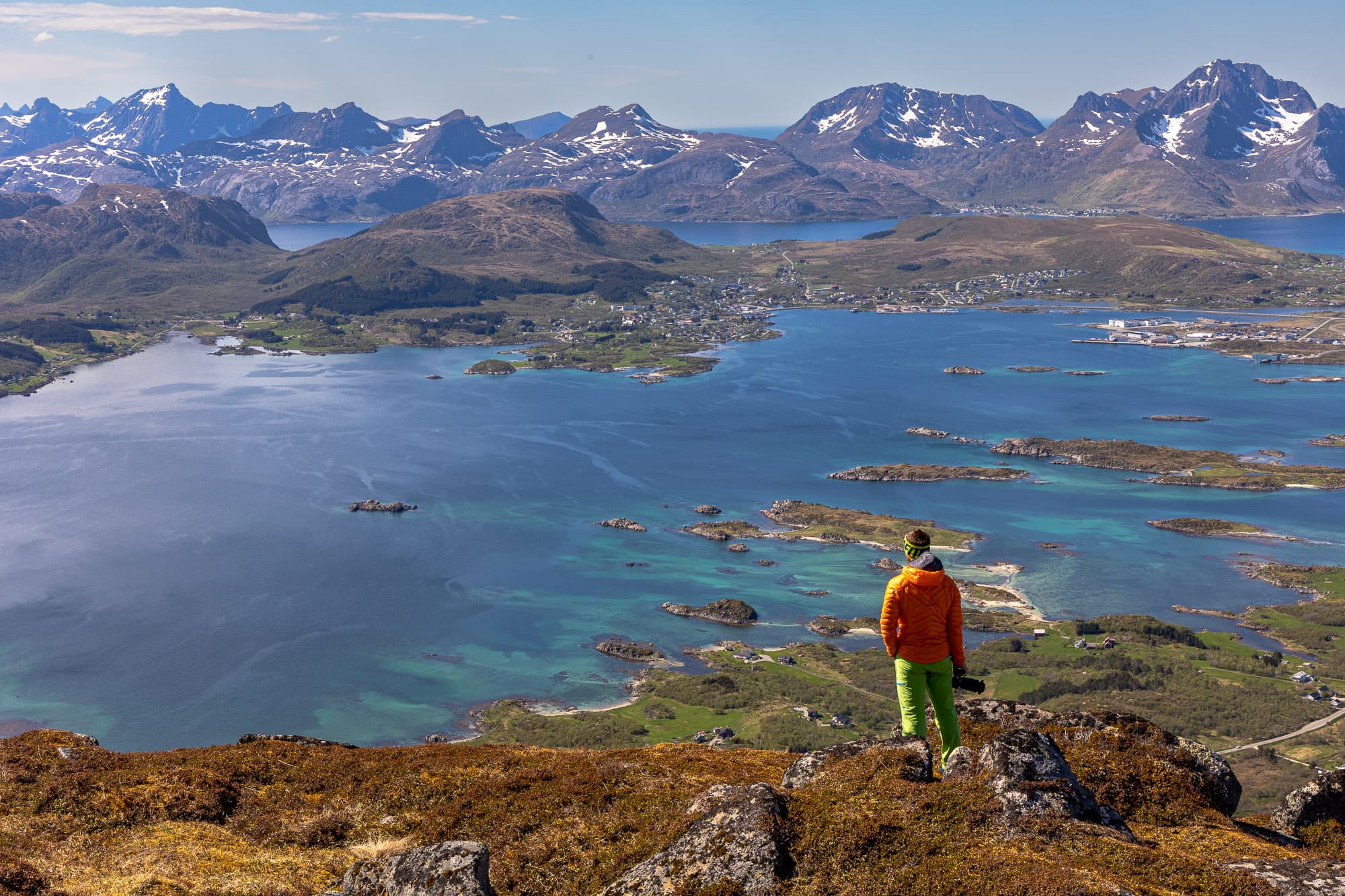
The first part is a bit boggy, but we're used to that on Norwegian hiking trails by now. We carefully cross the valley below the impressive double summit and manage to reach the turn-off at Andjordbakkan without getting our feet wet. Even on the ascent to the saddle between the two peaks of Guratinden, I am fascinated by the view of the Buksnesfjord. I have to stop again and again to let my gaze wander over the ever-shrinking coastal landscape around me. On the opposite side of the fjord, the houses of Leknes loll in the midday sun and one of the cruise ships that dock here almost every day is moored at the ship terminal. The ships moored directly at the jetty tend to be of the smaller variety, but the scale of the cruise ship and the surrounding buildings is simply impressive. Giants like the "Mein Schiff" and similar behemoths have to anchor a little further out in the bay and bring their passengers ashore by boat.
Up here, however, we don't notice any of the hustle and bustle or the buses distributing tourists to various excursions in all directions. Instead, we are all to ourselves. Since we met two hikers during the ascent to the saddle, we haven't seen another soul until we reach the summit. The peace and quiet that surrounds us here is wonderful.
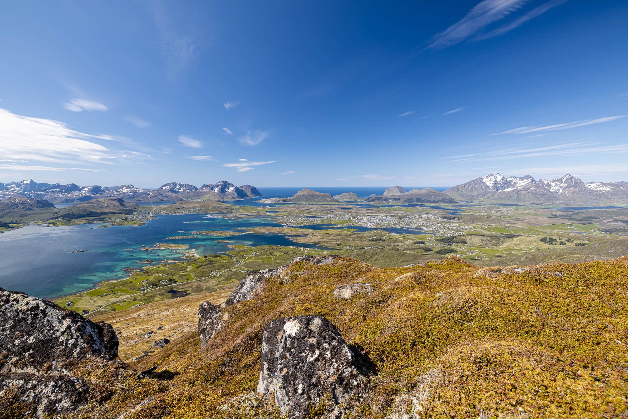
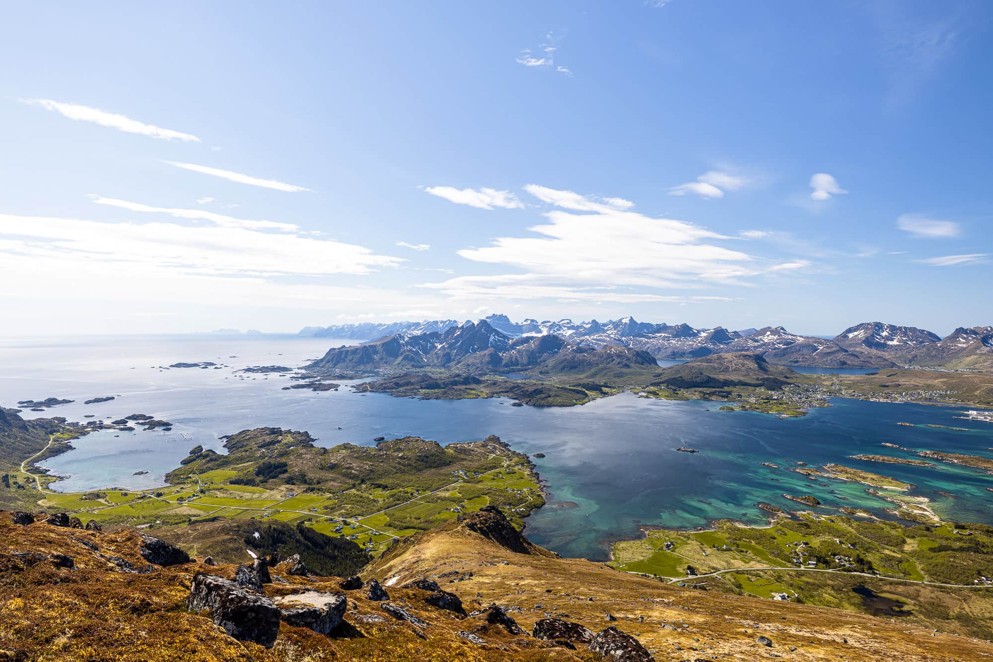
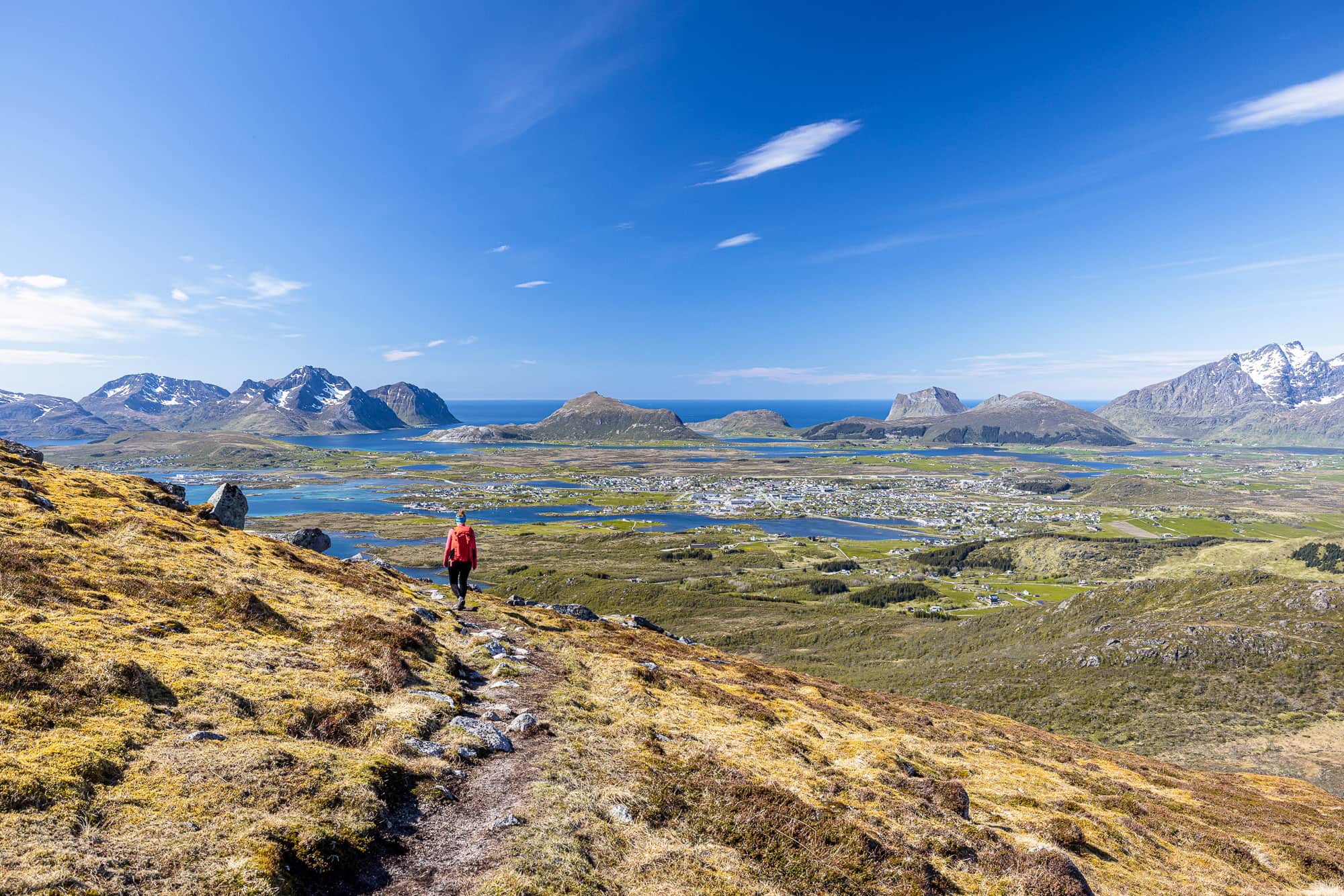
We are therefore in no hurry at the summit and take our time. Time for a long lunch break with delicacies from our rucksacks. Time to enjoy the warming rays of sunshine and, of course, to marvel at the incredibly detailed landscape that now lies at our feet. To the west, our gaze falls on Gravdal and Leknes, and a little further south we can even make out Ballstad, which nestles against the coast below Nonstinden. To the south is the open sea, until our eyes meet the distant peaks of the Norwegian mainland, which are only dimly visible in the midday haze.
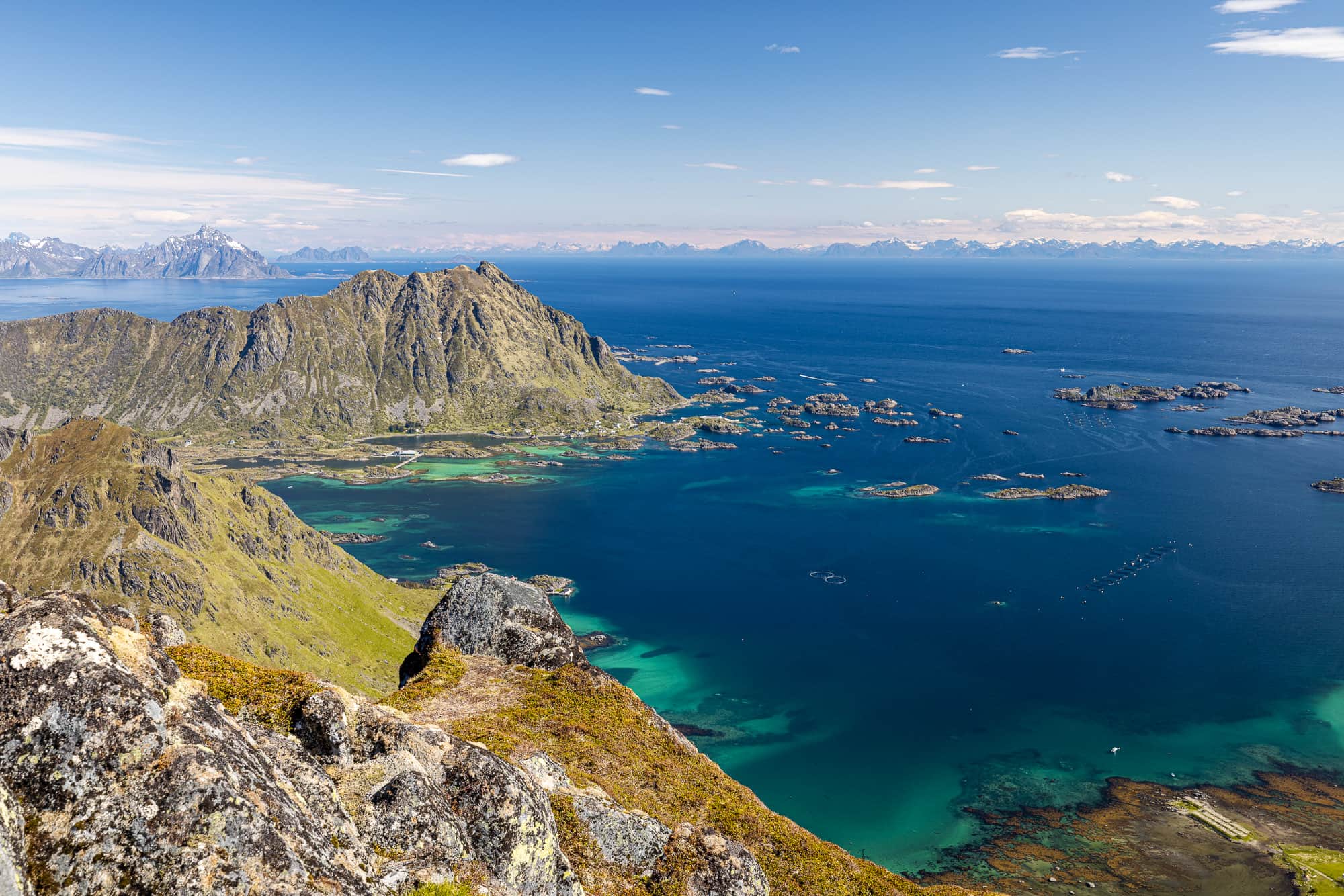
At the tip of the island opposite, Steinetinden rises out of the sea and the few houses of the settlement of Steine cling to its foot. The water around the small offshore islands shines up to us in an almost unreal turquoise and exudes a hint of the Caribbean. I don't know how long we sat wide-eyed on the summit of Guratinden and simply gazed at the landscape, but it must have been a long time. At some point, our snack box is empty and I stand up with stiff limbs to loosen up my legs before we start our descent.
The way down is the same as the way up, but it doesn't get boring. Now I can look in the other direction as I walk, to the top of Himmeltindan high above the beach at Haukland and Offersøykammen, whose summit offers an incomparable view to the west and is therefore a perfect vantage point to enjoy the midnight sun. And the rest of the afternoon? It's about as relaxed as the time at the summit of Guratinden - with sunbathing on the terrace and making plans for the evening ahead under a cloudless sky and midnight sun.


