
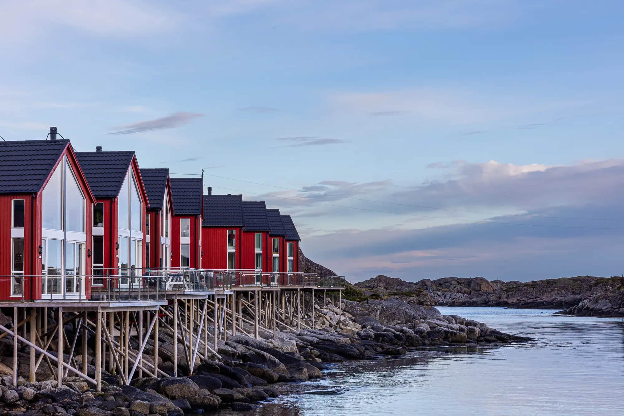
It is the end of May, when we are on the Lofoten Islands for the very first time in our lives, and to our surprise it can already get quite warm even this far up in the north. After work is done, we sit in T-shirts on the terrace of our temporary home and look over to Nonstinden. It’s one of those typical houses that line the coasts here in the far north – red wooden walls, white window frames and a view onto water and mountains. But where are we exactly?
Home mountain and heath above Ballstad
Our cabin is located in the quiet fishing village of Ballstad in the district of Vestvagøy, which actually already belongs to the larger villages in Lofoten, although we should probably rather put “larger” in quotation marks. The peninsula on which Ballstad is located is characterized by a mountain range that runs from north to south.
The highest peak, rather in the north, is the 670 meter high Skottinden, and the other jags and peaks extend to the southern end of the peninsula, where the rock runs out more or less abruptly towards the coast. Nonstinden is one of these peaks and lies directly above Ballstad, which nestles on the western side of the small mountain range and is thus well protected from the stormy west winds. These otherwise hit the Lofoten archipelago without restraint from the Atlantic.
Pure Spots.
Fine art prints from this location.


With its 460 meters above sea level, Nonstinden is not necessarily one of the highest peaks in Lofoten and probably not the most impressive. But what we like about this mountain rising directly from the Atlantic is its versatility. But more about that later.
The Ballstadheia, which is the heath above Ballstad, is about 200 m above sea level and divides the climb up to Nonstinden into a steep initial part and the less steep ascent to the summit.
Those who know us are aware that sitting on the terrace and enjoying the sun is not one of our standard activities. So it doesn’t take long until our fingers, or maybe rather our toes, start tingling. Instead of looking up at Ballstadheia from our deck chairs, we prefer to tie our running shoes and tackle the ascent as a trail run.
Over stock(-fish) and stone
Our starting point is in the very south of Ballstad, on the island of Gjermesøya, and our first challenge is not a steep climb, but the path through stinking stockfish. From about February to May, you can find the traditional wooden racks everywhere in Lofoten, on which the fish, tied together by their tails, hang to dry. The smell is not very pleasant (at least for my fine nose) and a creepy detail: The heads of the fish are cut off before hanging and also tied to the racks to dry. Looks a bit like something you’d have to get used to.
Quickly we find the right path to Nonstinden and already a few meters further we are on the hiking trail. Fortunately, the steep ascent quickly puts distance between us and the penetrating smell of fish and we can breathe again. And we do need the air.
The climb is steep and depending on which route you choose either secured with a few chains or interspersed with loose scree, but never really difficult. We opt for the scree and quickly gain altitude. After about 200 meters of altitude we already reach Ballstadheia and take a short breather. Perhaps it is more of a panoramic break, because the view that is already offered to us from here is just awesome.
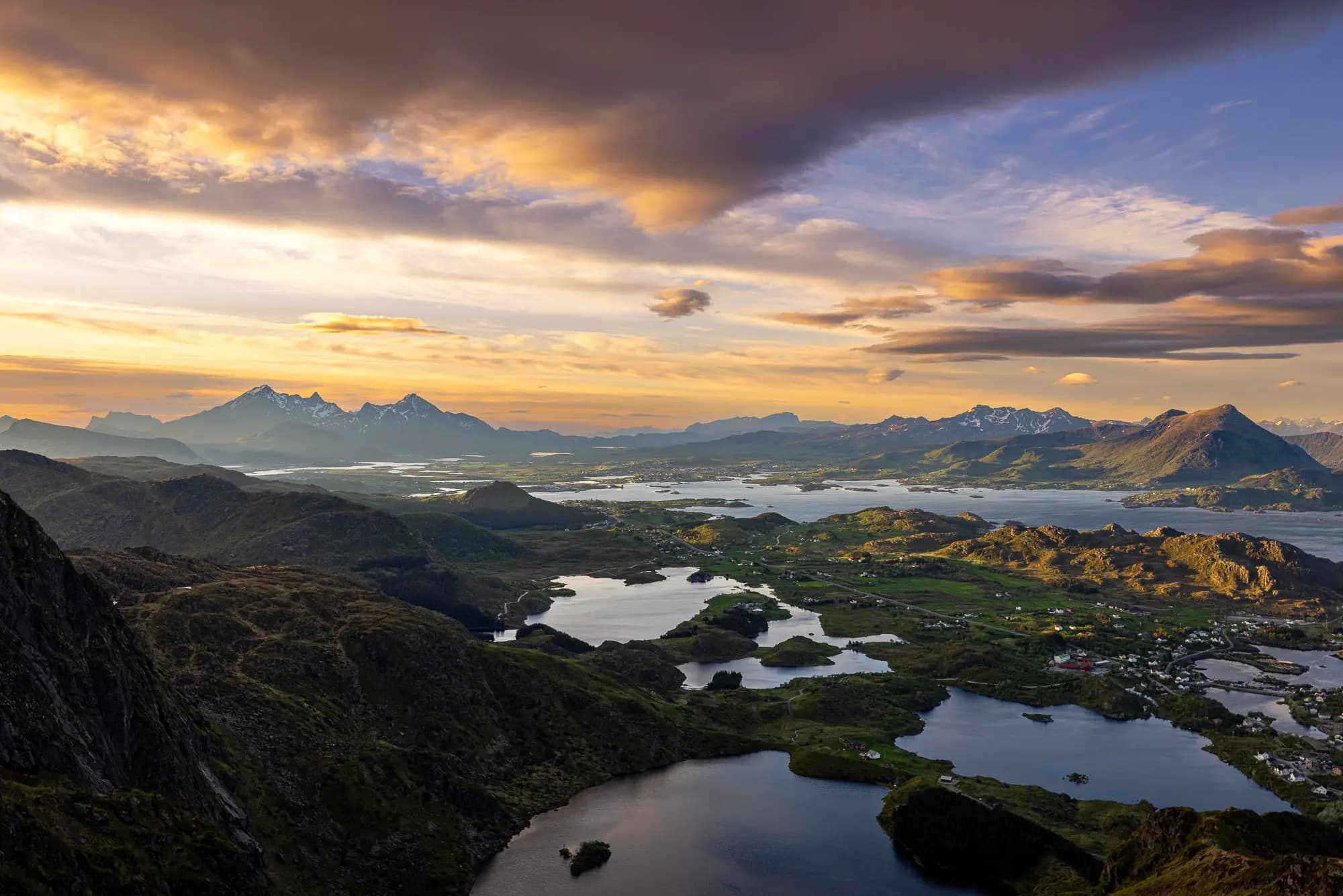
Vestvagøy to our feet
On the far right is the small island of Gjermesøya, where our cabin is located. Further to the left we can see the bay of Kræmmervika and a bit farther we can already see the roofs of Ballstad. In the background we spy Mortsund on another peninsula and discover Breitinden and Guratinden rising steeply from the sea.
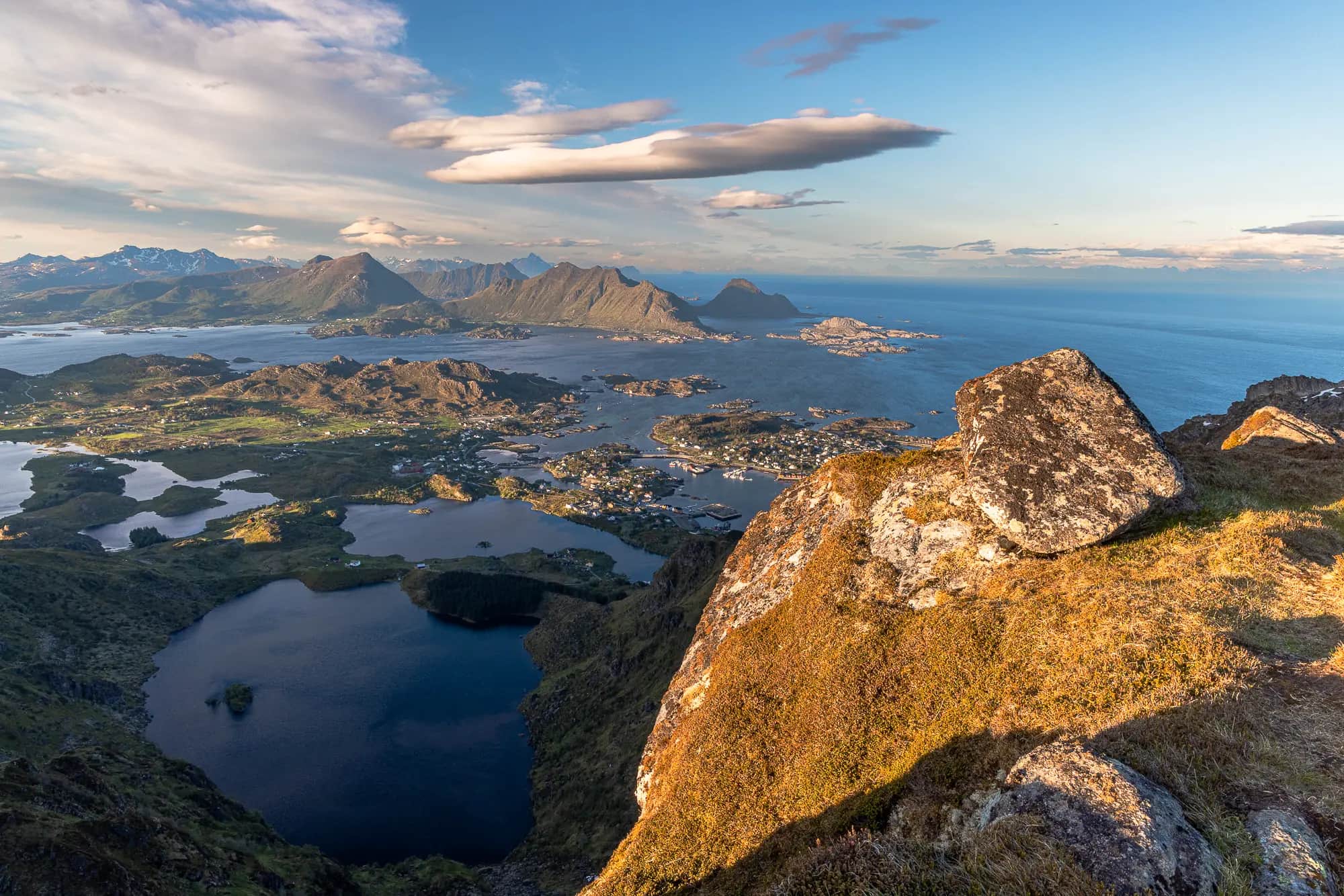
Over the Ballstadheia it is finally a bit flatter and our running style – or at least mine – finally reminds more of jogging than hiking again. 🥵 Meanwhile, a few clouds have gathered in the sky, which make the whole scenery around us extremely interesting in terms of light, but now and then also swallow the sun. Since we are no longer protected from the strong western winds up here, a rather fresh breeze blows around our noses and we try to stay warm by moving ourselves. The summit climb lets us then again come to sweat properly, because the terrain steeps up again a little more.
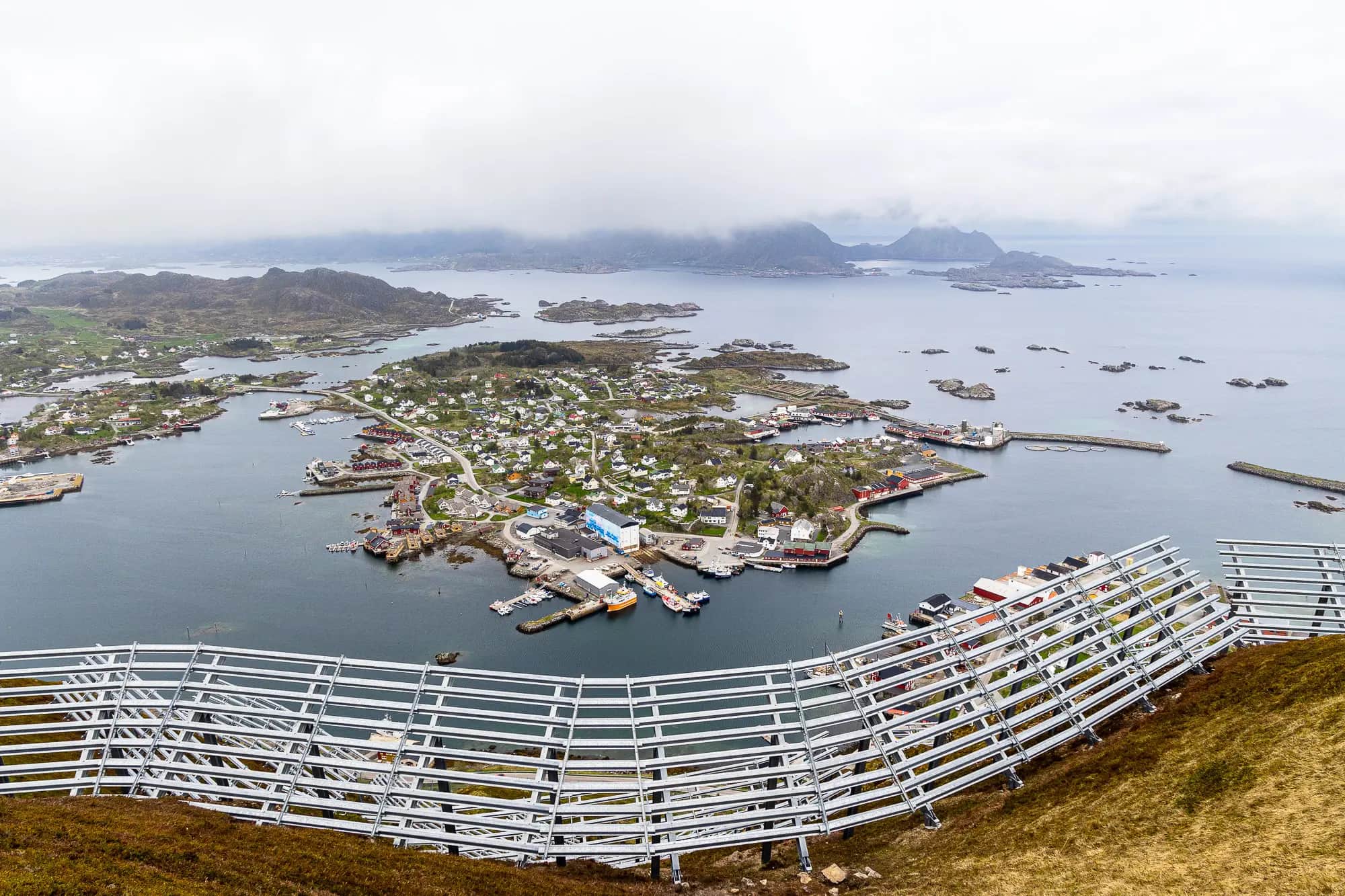
However, we are definitely rewarded for the effort to climb to the top of Nonstinden, because a breathtaking view awaits us up here. Our gaze wanders over Ballstad and the small harbor, follows the roads that look like a toy landscape from up here and gets stuck on countless islets and peninsulas. And despite the clouds, we can even make out the peaks on the opposite mainland.
Actually, we would love to stay much longer, marvel and discover – but we feel cold. The wind does not let up and so we start our way back. In a few minutes we are back at Ballstadheia and this time we decide to take the path that is secured with some chains. After another 20 minutes we reach sea level again. Then it’s a matter of holding our breath for a moment, scurrying through the stockfish and then we’ve made it. A perfect after-work trail run.
All-rounder with panoramic views
However, we didn’t want to leave it at Nonstinden with the trail run. In the next few days, we climbed the charming peak above Ballstad a few more times, hiking or running, and Falko even had enough strength and motivation to climb up in the golden light of the midnight sun, including photo equipment. And it was worth it every time. 😊
No matter what activity you do at Nonstinden, the home mountain of Ballstad is definitely worth one or more visits. And even if it looks rather unspectacular at first glance from below, the panorama from Ballstadheia and the summit is all the more impressive.


