
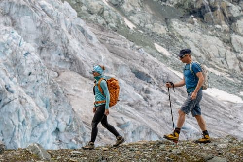
Hike to the Schäfler via Seealpsee

Hike to the Schäfler via Seealpsee

A Unique Circular Hike in the Appenzell Alps

Author: Falko Burghausen
Falko Burghausen
StoriesSeptember 2026

The hike from Wasserauen via Lake Seealpsee to Schäfler takes you through sections secured with wire ropes and past alpine rest areas to one of the most beautiful views in the Appenzell Alps, with a vista stretching all the way to Lake Constance.

Privately Guided Hikes

fromCHF 550

per day for 1 person
I

Privately Guided Hikes

Appenzell Alps

Wire ropes, steep steps, and a bit of a fear of heights? With a private guide by your side, you can tackle the Schäfler safely and with ease, off the beaten path.

Go to offer

After the tenth parking sign, I stopped counting. Rip suspects that the farmers here make more money renting out their meadows to hikers with cars than they do from milk and cheese. He’s probably right. The actual parking lots in Wasserauen have long been full, and we rattle across a meadow to a fenced-off area that’s serving as a parking lot today. Or has to, depending on who you ask.

First things first: Anyone looking for a quiet, peaceful hike all by themselves in the Swiss Alps should give Wasserauen, Lake Seealpsee, and the Schäfler a wide berth—at least in the summer and definitely on weekends. The picturesque landscape of the Appenzell Alps regularly attracts hordes of day-trippers, and things can quickly get crowded in the narrow valley basin of Wasserauen.

The hiking trail doesn’t waste any time and really kicks things off right from the start. Just under 300 meters of elevation gain separate Wasserauen from the famous Seealpsee at 1,142 meters. The alpine road gets quite steep, and we deliberately take it easy. While people around us are huffing and puffing, we chat relaxed and pace ourselves so that we’ll still have some energy left after reaching Seealpsee. After about 45 minutes, we arrive—along with a nasty headwind that no one would have expected in this sheltered valley basin. Countless people are milling about on the shore, and the Gasthaus Seealpsee beckons us to make our first stop. We remain steadfast. For now.
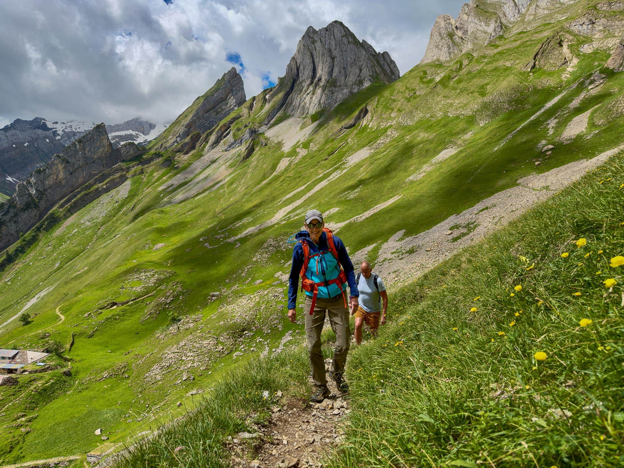
Steep climb toward Schäfler

We don’t know what the cows in the pastures make of all this commotion. In any case, at the end of the lake, they watch as we turn onto the hiking trail toward the Altenalp alpine farm, which takes us upward meter by meter along steep switchbacks. We have to climb about 450 meters in elevation, in some places on terrain secured with wire ropes and with a view of the deeply carved Wasserauen Valley that gets better with every switchback.

The Altenalp Alpine Farm at 1,595 m is our first rest stop on the hike to Schäfler. It’s located about two-thirds of the way to the popular scenic summit, and here you can refuel with traditional alpine products, listen to the cowbells and the Appenzell dialect, and watch as everyday life fades into the distance far below in the valley. Fresh alpine milk and homemade lemonade get us ready for the final steep 350 meters of elevation gain.
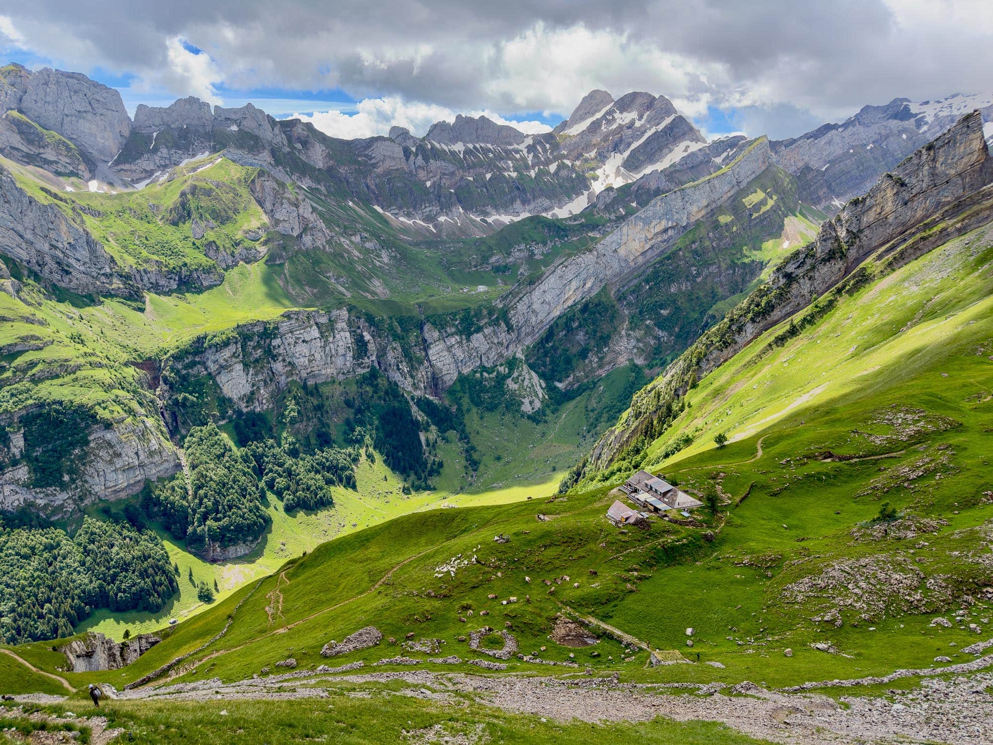
Altenalp Alpine Farm

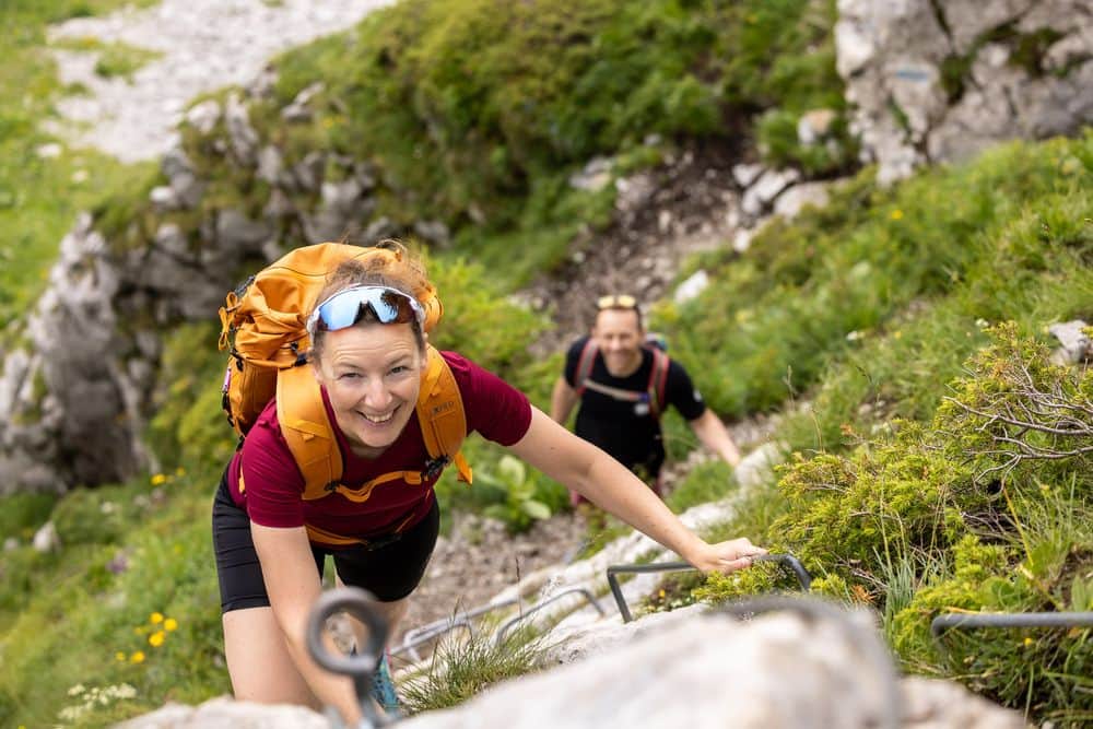
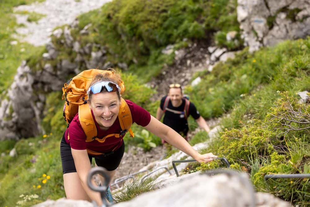
As we all know, “steep” is a relative term. However, the hiking trail from Altenalp to the Schäfler is unquestionably steep, and a head for heights is an absolute prerequisite for this hike. Below the Schäfler’s striking southwest face, the trail winds its way upward, secured in places with wire ropes and iron pegs. This isn’t for everyone, as the alarmed warnings from an oncoming group clearly demonstrate. We remain calm, are well-prepared, and tackle the key section step by step. My two guests, Rip and Suzie, master it with confidence and, a few minutes later, stand on their first summit in the Swiss Alps, right in the middle of their private hiking week. This is exactly what a first-time experience should look like.
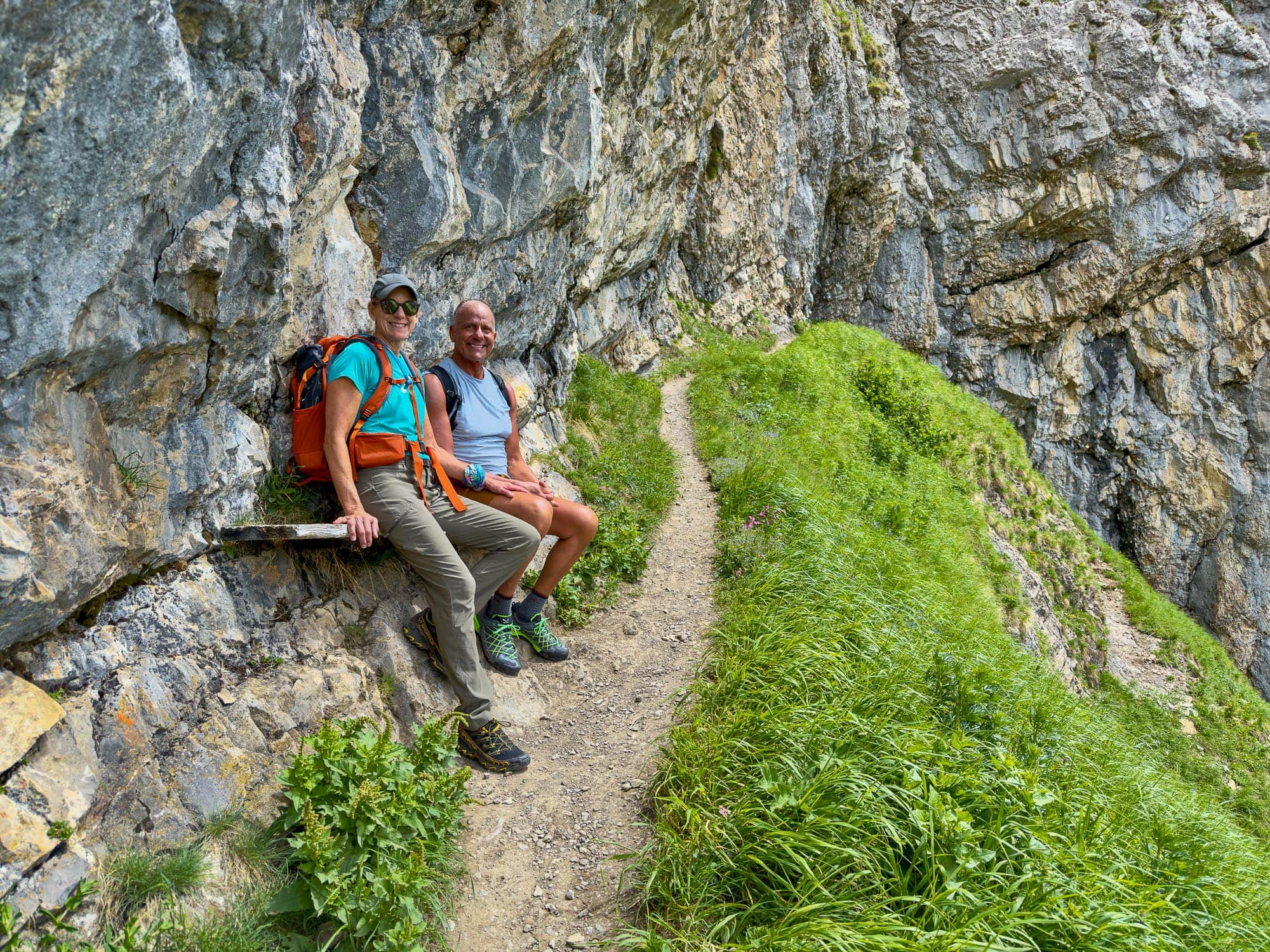
Must have a head for heights

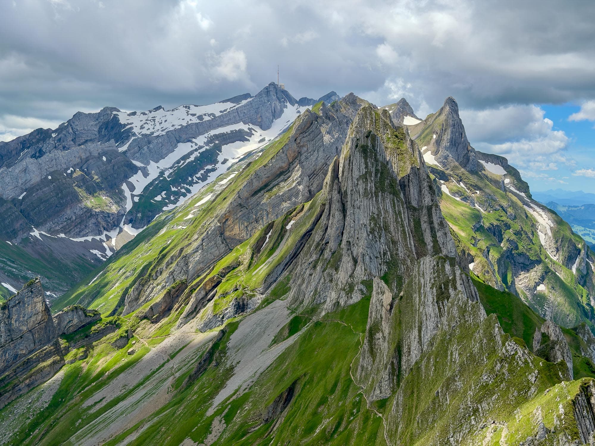
The summit of the Schäfler rewards us with a breathtaking view of the Appenzell Mountains and endless vistas of the Alpine foothills. From the Säntis to the Schäfler, the mountains form the first line of high peaks behind Lake Constance, rising up to 2,500 meters above the lowlands. The view sweeps across Switzerland, Germany, and Austria, and fades away somewhere in the haze beyond Lake Constance.
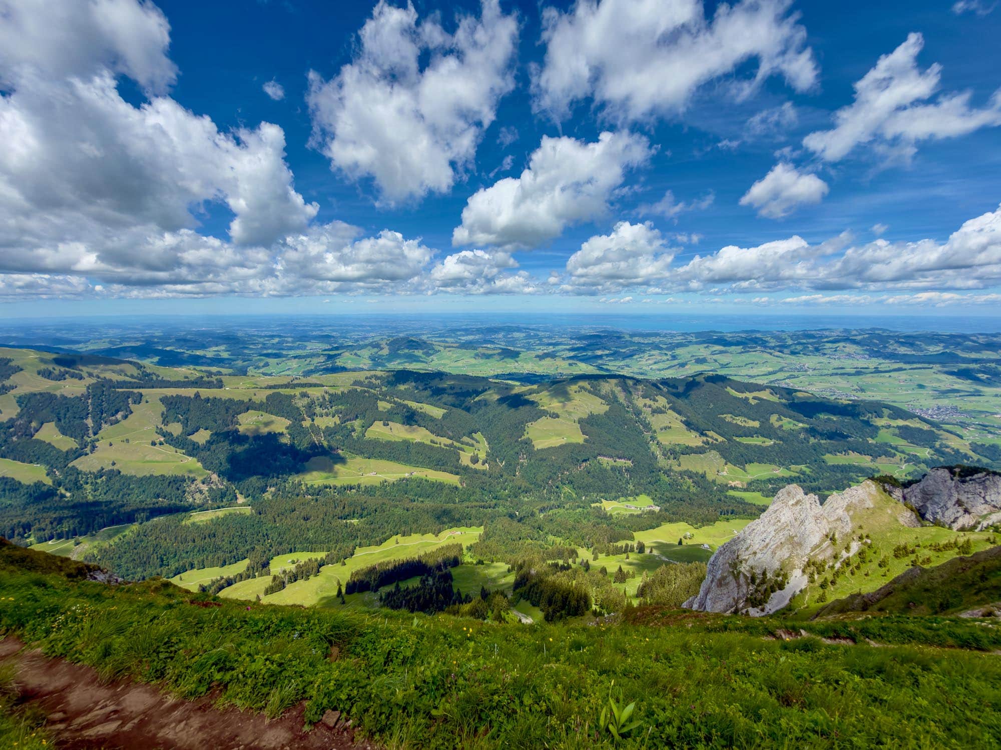
Endless View

The Berggasthaus Schäfler, located just below the summit, welcomes us with an amazingly wide selection of food and drinks. The large terrace is the perfect place to relax, let your gaze wander, and replenish the calories you’ve just burned with a clear conscience.

The trail continues steadily downhill toward Ebenalp, where a detour to the world-famous Berggasthaus Äscher is well worth it. With our small group, we’re skipping this detour this weekend—half the world seems to be lining up there anyway. Instead, we’ll end our hike—easier on the knees—at the top station of the Ebenalp Cable Car, which takes us back down to the valley in Wasserauen in just a few minutes, offering spectacular, sweeping views along the way. Hopefully, our car is still parked on that meadow.

You can also book the tour to the Schäfler with your own private guide and focus entirely on the view, while the guide takes care of all the logistics, route planning, weather, and conditions. Just contact me for more information.

Information about the route

Schäfler via Seealpsee and Altenalp
T3 (E2)

The trail to the Schäfler (1,925 m) is steep, spectacular, and secured in some sections with wire ropes and iron pegs. Despite the sometimes large crowds, it is a hike that is exposed in places and requires experience, sure-footedness, and a head for heights.

Facts & figures

Grade

Seriousness

Marking

Total time

Ascent

Descent

Highest point

Schäfler (1'925 m)

Distance

9 km

Region

SwitzerlandAppenzeller Alps

Activity type

Book a guide

With an experienced guide, you will experience this tour with new impressions and the good feeling of being safe on the road.

From Wasserauen, follow the well-marked hiking trail toward Seealpsee. The steep ascent runs mostly along the alpine road; only a short section between P. 915 and P. 961 can be bypassed via a hiking trail.

Pass Seealpsee on the north side and leave the alpine road heading north at P. 1147. From here, follow the hiking trail—which is steep and exposed in places (with short sections secured by wire ropes)—up toward Altenalp (1,525 m). From Altenalp, the most difficult section of the trail begins; it is extremely steep and exposed, secured with wire ropes and iron pegs, and leads toward the summit of the Schäfler. At the summit ridge, you’ll reach the trail coming from the west via Läden and follow it eastward for a few meters around the summit of the Schäfler. The actual summit is reached via a short trail, while the Schäfler mountain inn lies a few meters below.

The descent follows the trail toward Ebenalp and leads easily via P. 1830 to an alpine hut near P. 1724. Here the trail forks: follow the trail straight ahead toward Ebenalp. A long traverse follows to P. 1630, where you can either descend in a slight arc past the Ebenalp mountain inn or head directly to the Ebenalp cable car’s mountain station.

The hiking trail leading up to the Schäfler is rated T3. The descent to Ebenalp can be rated T2.

Even the first section of the trail from Seealpsee is steep and exposed in places. A head for heights and sure-footedness are absolutely essential from this point on.

From Altenalp onward, the route to the summit does not get any easier; the trail is steep, exposed, and secured with steps, wire ropes, and iron pegs. The surface consists of loose gravel and can be tricky without sufficient experience. The final stretch to the ridge requires some light use of the hands, while the subsequent traverse around the summit demands a head for heights.

The entire route from Seealpsee to the summit is extremely treacherous in wet or snowy conditions. The Appenzell Alps region is known for serious mountain accidents involving hikers and should not be underestimated, despite its picturesque setting.

Best season

From June through fall, as long as the route is free of snow. If there is lingering snow, the hike up the Schäfler can quickly become treacherous; however, because the trail faces mostly south, most of the route is usually easily passable. Special attention should be paid to the north-facing and very exposed section on the Schäfler’s summit ridge, which can be extremely treacherous when there is snow.

In general, due to its steepness, the hike to the Schäfler is recommended only in dry conditions.

Arrival

From Appenzell, follow the road to Weissbad and continue into the valley to Wasserauen. The road is well marked. The Appenzeller Bahnen trains run from St. Gallen and Urnäsch to Wasserauen.

Starting point

The starting point is Wasserauen at 868 m. This small town is easily accessible by train or car, though visitors should be aware that parking is limited, especially during the summer months and on weekends.

View on Google Maps

Good to know

The ascent passes by the well-known and picturesque Seealpsee

A leisurely stop at the Altenalp is possible

Stunning views of the Alpine foothills from the Schäfler summit

Summit restaurant at the Schäfler with a wide selection of food and drinks

It’s possible to make a detour to the Äscher mountain inn

Date of the information

June 2026

Our partners

beAnywhere is a verified partner and author at Outdooractive. Follow us for even more inspiration and detailed tour tips.

Share article

Trail & Chill Newsletter

Receive a relaxed mountain feeling and other exciting news about trail running, hiking and photography straight to your inbox.
You can find my privacy policy here.

About Falko Burghausen

Falko Burghausen

Falko is at home in the mountains all year round, whether on high-altitude tours, climbing, ski touring, ice climbing, or on alpine trails. In winter, he is also drawn to the cross-country ski trails as Swiss Snowsports Ski Instructor. As a Swiss Athletics Trail Running Instructor, he teaches you an efficient, safe, and fluid running style and is currently training to become a UIMLA Mountain Leader at the VDBS. Equipped with his camera, he captures the great moments of being outdoors as a multi-award-winning international photographer—full of emotion, vastness, and a genuine thirst for adventure.

To the biography