A long day comes to an end
After more than eight hours we feel hard asphalt under our hiking boots again for the first time. “Shall we go up or down?” Falko asks me from the side without letting his preference for the last part of our way shine through. “Down” is my answer short and decisive. Because up would mean that we would have to ascend another 72 metres in altitude, only to descend them again on our remaining descent to Biasca. 72 metres of altitude difference is not really much when hiking. But after having climbed more than 2000 metres in ascent and descent to Forcarella di Lago since this morning, this number of metres in altitude now seems insurmountable to me. We are going down.
Shortly afterwards we are standing next to our car in Biasca. With tired legs, hot feet, stiff back and a broad smiling face. On this car park, which is meanwhile heated up by the sun, we started our hike in the morning.
Departure in Biasca
In the morning the air is still cool and the roads are shaded by the steeply rising massif of the Pizzo Magn. On the hiking sign, which shows us the way out of the alleys of Biasca, it says black on yellow “Capanna Cava: 5 hours 50 minutes”. In my head I frantically estimate the time for the descent from the hut, which is the furthest point of our hike, and conclude: This will be a long day.
With every step and every meter of altitude the view over the valley widens. The houses are getting smaller, the cars now look like toy cars, curving through the streets remotely controlled. In the valley, the highway from the south into the Valle Leventina in the direction of the Gotthard joins in on the left and on the right the sports centre with football pitch and tartan track spreads out sleepily in the shade. We climb 600 metres in altitude with this view, which gives the impression of endlessly slowly zooming out of the valley basin. The noise of civilisation, the sound of engines, horns, bells, the noise of construction sites. Everything is lost in the soft sounds of nature that surround us. Lizards rustling nervously in the leaves and insects hissing past our ears.
Alp Pianezza – jewel above Biasca
We walk in silence and lost in thought, almost meditative. Until we reach Alp Pianezza, a real gem high above Biasca. Our monotonous walk is interrupted by the small hamlet, which is managed in summer, and we look around curiously between the buildings. Unfortunately, at the beginning of September there are neither goats nor people, but everything gives the impression that the rustici have been prepared with great attention to detail. The meadows have been mowed not too long ago and the wells are labelled. One of them carries drinking water and we take the opportunity to fill up our reserves. A small shed was perhaps once a smithy. On the wall next to the restored gate hang finely and neatly in a row of different tools, hammer and anvil are ready. Everything reminds us of former times, like in an open-air museum.
##Once not paying attention, already wrong turn
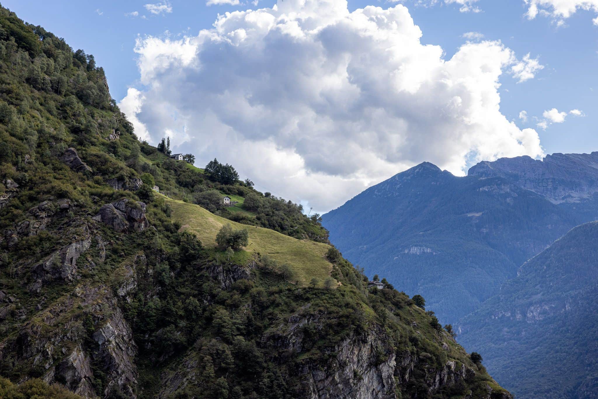
We could sit here all day long and let our gaze wander over the valley of Biasca, but we are drawn further on. We want to go higher. A few serpentines later we meet contemporary witnesses who tell us a different fate. Not all the former Alps are still farmed today and the ruins of the collapsed rustici show the abandonment, decay and emigration to which many of the remote hamlets are subjected.
At Alpe di Compiett, smoke rises from the chimneys. The huts push themselves to the edge of the small plain. Here too we do not meet a soul. The small waterfall of the Ri della Froda captivates our eyes and for a moment we lose sight of the path. Along the course of the river we look for the tracks that will lead us to Alpe di Lago. To the left? On the right? Go back! The realisation: we have been tempted by the tracks of the forest workers and missed the turnoff to Capanna Cava.
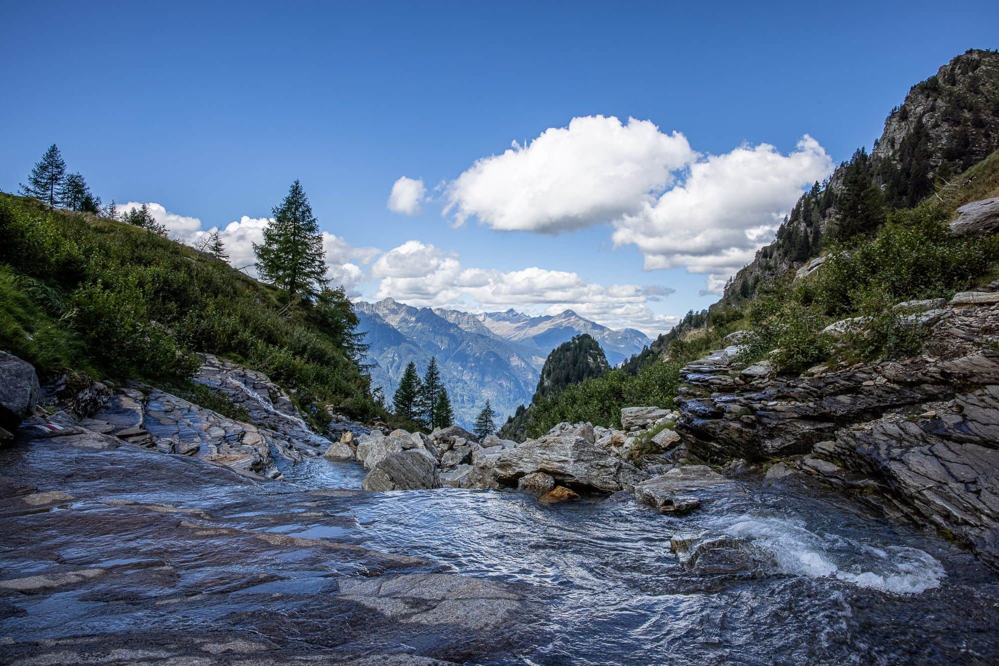
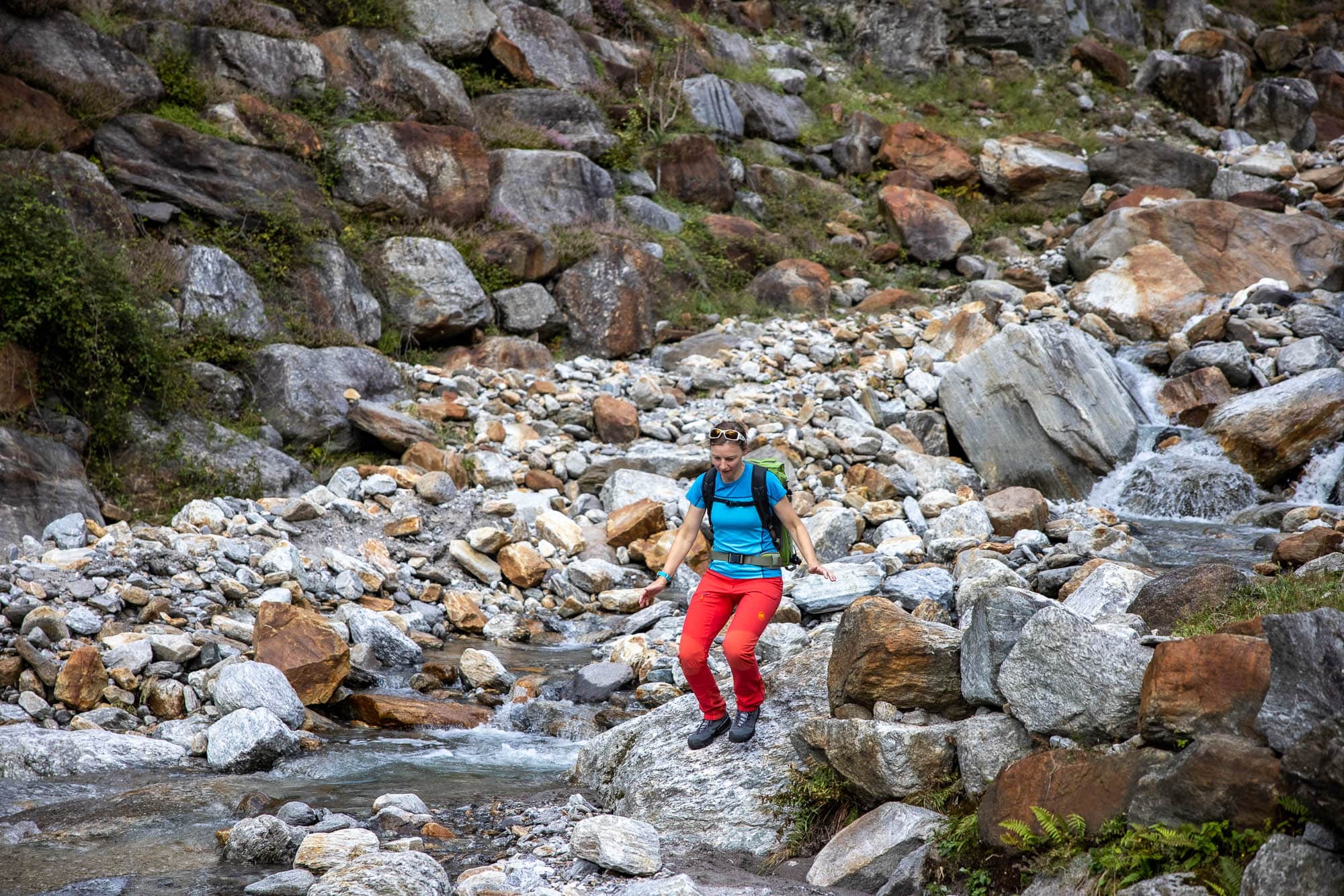
Lago – simple but beautiful
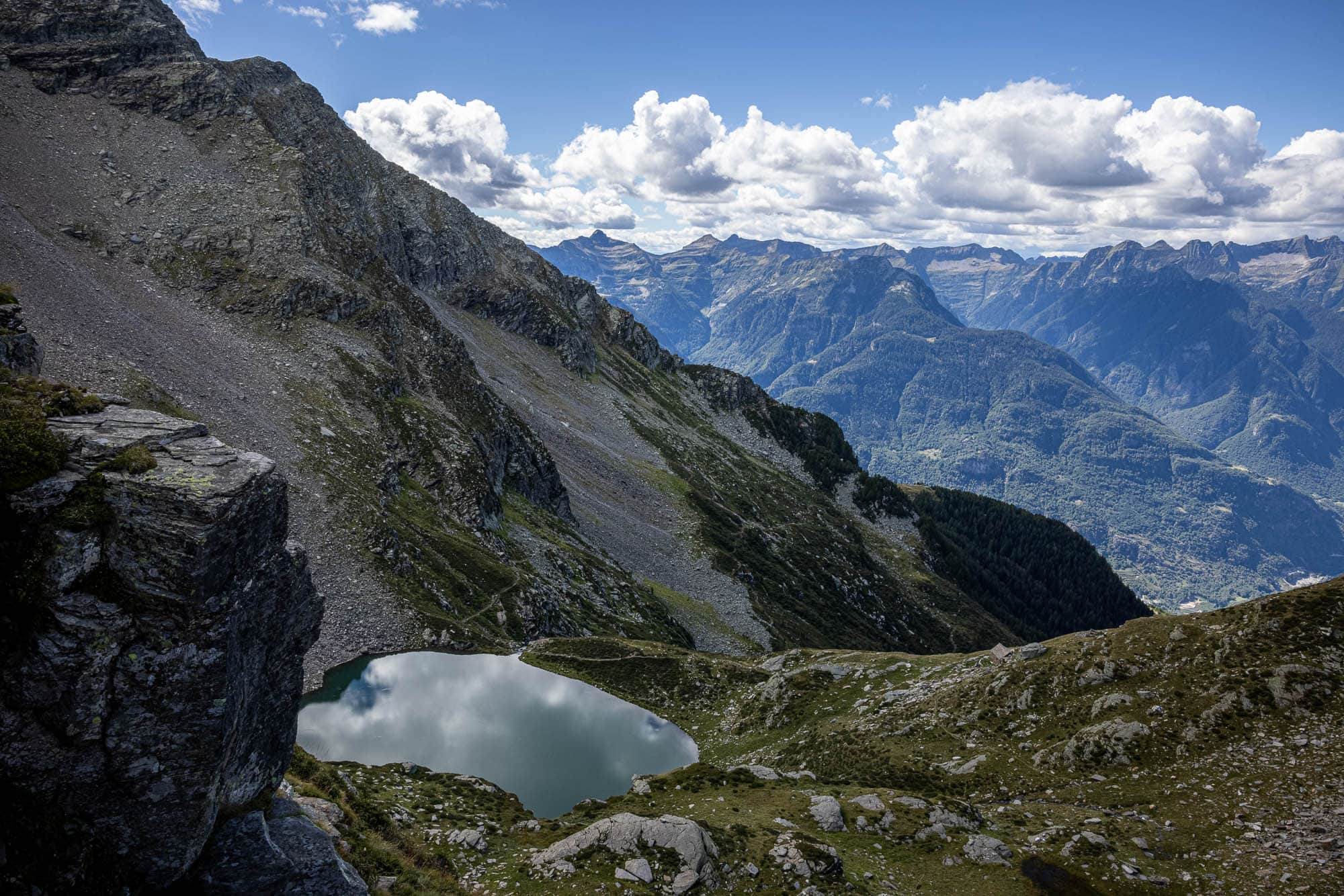
The steep trails up to the Rifugio cross stony streams and test our long jump technique. I think I can still work on my grace. 🙈 At the rifugio itself, the view of the small mountain lake Lago compensates for the effort that was necessary to get here. Lago, what next? The lake has indeed not been given another name and more than a sonorous name it enchants with the reflection of the surrounding mountains and passing clouds. Directly behind the stone building, a wall of rock and grass builds up. The path winds along a clear line through this rocky ridge, which at first sight seems insurmountable, to Forcarella di Lago. What awaits you at the pass itself remains hidden behind solid rock until the very end.
Forcarella di Lago – after 2000 meters of altitude finally at the destination
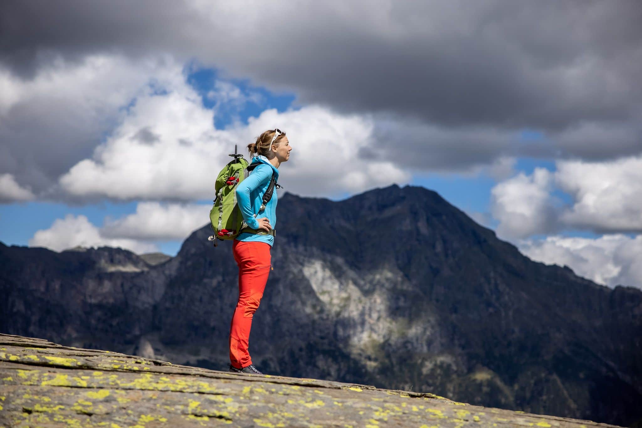
A last zigzag between boulders, then the narrow passage is reached at the highest point. After 2000 metres of ascent, the rocks suddenly recede and make way for a stunning panorama. Our gaze wanders over the plateau of Alpe di Cava, which spreads out below us like a fan. On the left are alpine buildings, a herd of cows grazing nearby. On the right are the lakes Laghetti di Cava and in the middle of it all is the Capanna Cava with its enticing terrace. The scenery is lined by a series of almost three thousand metre peaks, the highest of which culminates in the Torent Basso. Views that reward for the ascent. Our leg muscles are grateful for a longer break, which we take here. Not least because there is still a long descent waiting for us.
Long descent back to the valley to Biasca
We leave the Capanna Cava on the right before we take the path towards Biasca on the north-eastern flank of the Pizzo Magn above the Val Pontirone. Over the first few kilometres that we walk out of the valley, we lose very little height. Without looking at the altimeter, I would have the feeling of gaining more height than losing due to the many tiny counter climbs. But as soon as we round the last shoulder of the terrain, it can hardly be steep enough downhill. In narrow hairpin bends the path finds its way through sparse beech forests and light hazel bushes.
Just as we look forward to the valley, the numbers on the display of my GPS watch tumble. “Only 400 metres more to go” I joyfully announce every time we fall below the hundred mark again. But Falko doesn’t want to hear that. He just wants to go, the quicker the better. Because the long way down to the valley is not exactly one of his favourite activities.
With every meter of altitude we lose and get closer to our starting point again, it gets a bit warmer in the afternoon sun, our legs a bit heavier, our back a bit stiffer. And our mood? Getting better with every step. We meet the first walkers when Falko notices: “Are you actually aware that we haven’t met a soul all day except for two elderly people at their rustici?” He is right. Rarely have I taken such a lonely walk starting directly from a town as I have here. If you are looking for lonely paths, varied climbs, peaks with spectacular views and extensive routes, you will love the hiking paradise around Biasca and in the Blenio Valley.
After more than eight hours we are at a crossroads a few metres above Biasca. “Up or down long?” The decision is simple. Because now we have to climb another 72 metres before we finally reach our starting point, our destination, would be a bit too much of a good thing.